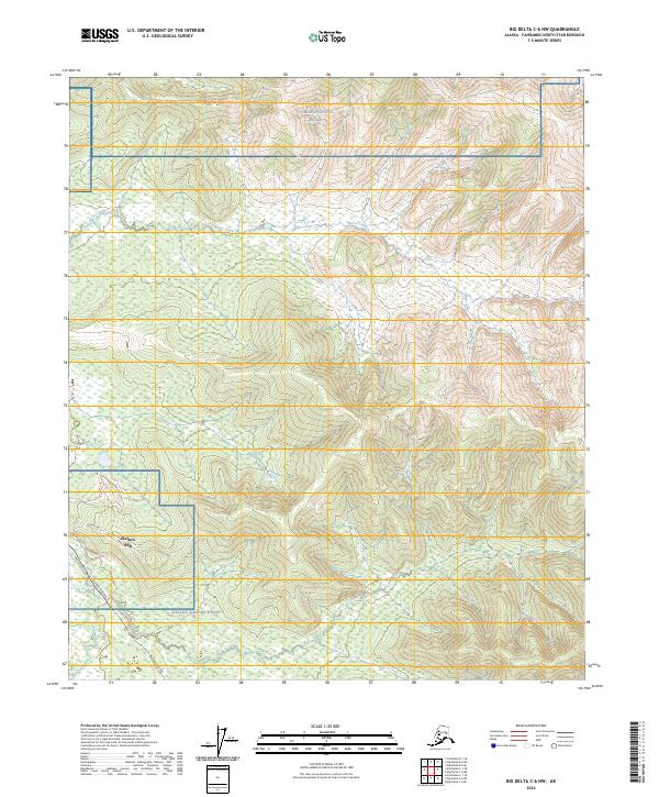
2024 Map of Big Delta C-6 NW
USGS Topo · Published 2024About this map
Eielson Air Force Base dominates the southwestern corner of this modern topographic study, showing the intersection of strategic military operations and northern infrastructure. The boundary of Eielson AFB is clearly delineated alongside the vital corridor of the Alaska Pipeline, which runs north-south through the western terrain. This infrastructure is supported by a network of service routes including Pipeline Access Rd and Quarry Rd. To the north, the expansive Yukon Weapons Range occupies the higher elevations, illustrating the scale of military land use in the Fairbanks North Star Borough. The natural landscape is defined by the winding paths of Moose Creek and French Creek, which cut through the hills and wetlands between the military installations and the pipeline corridor, reflecting the character of the Alaska interior in the 2020s.
Find a feature on this map
13 named features on this map. Tap any name to fly to it.
Don’t see what you’re looking for? This feature index may not catch every label — zoom into the map to look around manually.
Map Details
Editions of this 2024 Big Delta C-6 NW Map
This is the sole edition of this map. No revisions or reprints were ever made.
Other maps of this area

1949 · Fairbanks D-1
USGS Topo · 1:62,500

1949 · Fairbanks C-1
USGS Topo · 1:63,360

1949 · Big Delta C-6
USGS Topo · 1:63,360

1950 · Fairbanks
USGS Topo · 1:250,000

1950 · Big Delta
USGS Topo · 1:250,000

1950 · Big Delta D-6
USGS Topo · 1:63,360

1950 · Fairbanks C-1
USGS Topo · 1:63,360

1951 · Big Delta
USGS Topo · 1:250,000

1951 · Fairbanks
USGS Topo · 1:250,000

1952 · Big Delta C-6
USGS Topo · 1:63,360