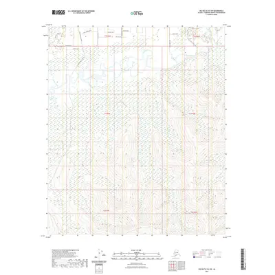
2021 Map of Big Delta D-6 SW
USGS Topo · Published 2021About this map
Chena River meanders across the northern portion of this landscape, creating a complex system of wetlands and side channels including Mullen Slough. The terrain transitions from these low-lying riparian zones to significant upland relief in the south, where Horner Creek and Flat Cr drain the higher elevations. A sparse but deliberate network of local roads and named paths, such as Snow Leopard Drive and Paw Print Path, suggests a modern rural settlement pattern north of Baseline Road. The presence of the Steve Savage Trail and Chena Access Lane indicates the area's importance for local transit and recreational river access. This 2021 survey illustrates the precise intersection of natural drainage and modern residential infrastructure in the Fairbanks North Star Borough.
Find a feature on this map
25 named features on this map. Tap any name to fly to it.
Don’t see what you’re looking for? This feature index may not catch every label — zoom into the map to look around manually.
Map Details
Editions of this 2021 Big Delta D-6 SW Map
This is the sole edition of this map. No revisions or reprints were ever made.
Other maps of this area

1949 · Fairbanks D-1
USGS Topo · 1:62,500

1949 · Fairbanks C-1
USGS Topo · 1:63,360

1949 · Big Delta C-6
USGS Topo · 1:63,360

1950 · Fairbanks
USGS Topo · 1:250,000

1950 · Big Delta
USGS Topo · 1:250,000

1950 · Big Delta D-6
USGS Topo · 1:63,360

1950 · Fairbanks C-1
USGS Topo · 1:63,360

1951 · Big Delta
USGS Topo · 1:250,000

1951 · Fairbanks
USGS Topo · 1:250,000

1952 · Big Delta C-6
USGS Topo · 1:63,360