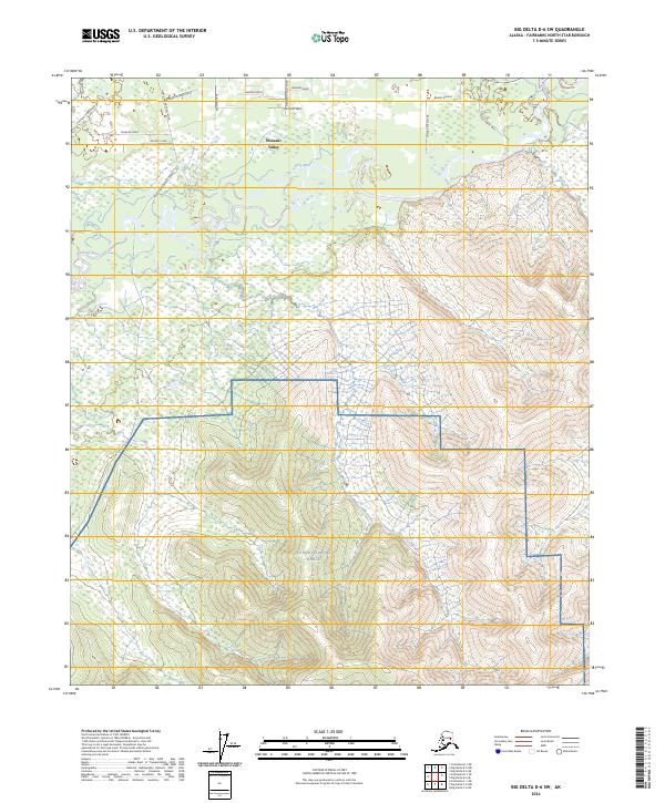
2024 Map of Big Delta D-6 SW
USGS Topo · Published 2024About this map
Pleasant Valley serves as a central point of habitation in this Interior Alaska landscape, where residential corridors like Snow Leopard Drive and Paw Print Path extend into the surrounding wilderness. The hydrology of the region is dominated by the winding course of the Chena River, which is joined by Mullen Slough and various tributaries including Horner Creek and Flat Creek. This 2024 survey illustrates a clear division between civilian settlement and military utility, as the southern portion of the map transitions into the restricted territory of the Yukon Weapons Range. Movement through the area relies on a network of localized thoroughfares such as Pheasant Farm Road and the Steve Savage Trail, reflecting the modern infrastructure required to navigate the dense woods and river valleys of the Fairbanks North Star Borough.
Find a feature on this map
27 named features on this map. Tap any name to fly to it.
Don’t see what you’re looking for? This feature index may not catch every label — zoom into the map to look around manually.
Map Details
Editions of this 2024 Big Delta D-6 SW Map
This is the sole edition of this map. No revisions or reprints were ever made.
Other maps of this area

1949 · Fairbanks D-1
USGS Topo · 1:62,500

1949 · Fairbanks C-1
USGS Topo · 1:63,360

1949 · Big Delta C-6
USGS Topo · 1:63,360

1950 · Fairbanks
USGS Topo · 1:250,000

1950 · Big Delta
USGS Topo · 1:250,000

1950 · Big Delta D-6
USGS Topo · 1:63,360

1950 · Fairbanks C-1
USGS Topo · 1:63,360

1951 · Big Delta
USGS Topo · 1:250,000

1951 · Fairbanks
USGS Topo · 1:250,000

1952 · Big Delta C-6
USGS Topo · 1:63,360