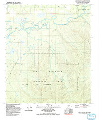
1992 Map of Big Delta D-6 SW
USGS Topo · Published 1992About this map
Fort Wainwright military lands dominate the southern portion of this landscape, where the Maneuver Area and the Chena River Research Site reflect the mid-century intersection of defense and environmental study in Alaska. The Chena River meanders across the northern half, feeding a complex network of wetlands including Mullen Slough and Jenny M. These water bodies are flanked by the Chena River State Recreation Site Tract A, emphasizing the region's dual identity as both a high-use military training ground and a protected wilderness space.
Find a feature on this map
19 named features on this map. Tap any name to fly to it.
Don’t see what you’re looking for? This feature index may not catch every label — zoom into the map to look around manually.
Map Details
Editions of this 1992 Big Delta D-6 SW Map
This is the sole edition of this map. No revisions or reprints were ever made.
Other maps of this area

1949 · Fairbanks D-1
USGS Topo · 1:62,500

1949 · Fairbanks C-1
USGS Topo · 1:63,360

1949 · Big Delta C-6
USGS Topo · 1:63,360

1950 · Fairbanks
USGS Topo · 1:250,000

1950 · Big Delta
USGS Topo · 1:250,000

1950 · Big Delta D-6
USGS Topo · 1:63,360

1950 · Fairbanks C-1
USGS Topo · 1:63,360

1951 · Big Delta
USGS Topo · 1:250,000

1951 · Fairbanks
USGS Topo · 1:250,000

1952 · Big Delta C-6
USGS Topo · 1:63,360