1951 Map of Big Delta
USGS Topo · Published 1954About this map
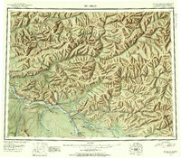
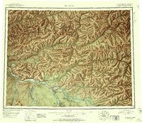
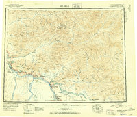
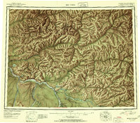
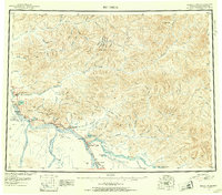
Big Delta and the burgeoning Delta Junction serve as the focal points of this mid-century interior Alaskan survey, where the recently completed Alaska Highway meets the Richardson Highway. This junction marks a pivotal era of land-based transport and military expansion, with the Ladd Air Force Base Bombing and Gunnery Range occupying a significant portion of the western territory. The map documents early roadside infrastructure such as the Shaw Creek Lodge and Alaska Lodge, alongside the long-established Richardson settlement. The landscape is defined by the massive braided courses of the Tanana River, Little Delta River, and Gerstle River. For researchers, the presence of an Indian Village near Healy Lake and numerous isolated cabins along the Salcha River and Chena River provides a record of subsistence and early settlement patterns in the Fourth Judicial Division.
Find a feature on this map
35 named features on this map. Tap any name to fly to it.
Don’t see what you’re looking for? This feature index may not catch every label — zoom into the map to look around manually.
Map Details
Editions of this 1951 Big Delta Map
4 editions found
Historical Maps of Delta Junction Through Time
3 maps found