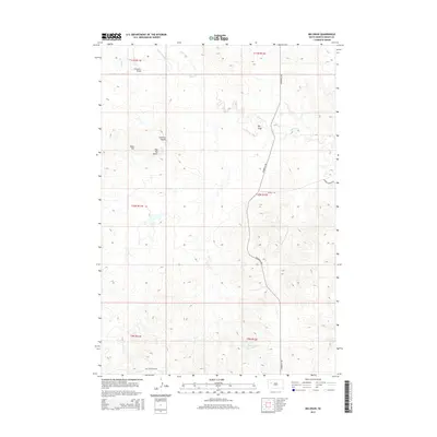
2015 Map of Big Draw
USGS Topo · Published 2015About this map
Sulphur Cr and its tributaries carve a network of drainage basins across this Meade County landscape, where the high plains transition into a series of named topographic landmarks. Notable elevations like Lookout Butte, Rizer Hill, and Flat Top Butte provide orientation markers in an area defined by significant depressions and eroded features, including the central Big Draw and the distinctively named Poverty Pinnacles to the east.
Find a feature on this map
19 named features on this map. Tap any name to fly to it.
Don’t see what you’re looking for? This feature index may not catch every label — zoom into the map to look around manually.
Map Details
Editions of this 2015 Big Draw Map
This is the sole edition of this map. No revisions or reprints were ever made.
Other maps of this area

1953 · Rapid City
USGS Topo · 1:250,000

1957 · Rapid City
USGS Topo · 1:250,000

1959 · Fairpoint
USGS Topo · 1:24,000

1959 · Redowl
USGS Topo · 1:24,000

1959 · Stoneville
USGS Topo · 1:24,000

1973 · Frozen Man Creek
USGS Topo · 1:24,000

1978 · Bull Run Creek
USGS Topo · 1:24,000

1983 · Opal West SE
USGS Topo · 1:24,000
1983 · Squaw Buttes
USGS Topo · 1:24,000
1983 · Big Draw
USGS Topo · 1:24,000