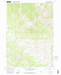
1966 Map of Big Elk Mtn
USGS Topo · Published 1986About this map
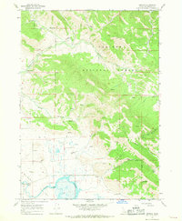
Keenan City (Site) marks a point of historical interest in the southern portion of this mid-1960s survey, where the drainages of Keenan Creek and Barnes Creek meet. Situated within the Caribou National Forest, the landscape is defined by the high elevations of Big Elk Mtn and Little Elk Mountain. The area known as Caribou Basin is central to the sheet, containing the Caribou Basin Guard Station near the winding course of McCoy Creek. A network of pack trails and jeep trails provides the only passage through this mountain terrain, following natural corridors like Miners Delight Creek and Wolverine Creek. The distribution of these trails and the designation of the townsite reflect an era of resource management and historical mining activity, where remote outposts and seasonal guard stations were essential to navigating and overseeing the Idaho backcountry.
Find a feature on this map
24 named features on this map. Tap any name to fly to it.
Don’t see what you’re looking for? This feature index may not catch every label — zoom into the map to look around manually.
Map Details
Editions of this 1966 Big Elk Mtn Map
Other maps of this area

1932 · Irwin
USGS Topo · 1:96,000

1935 · Irwin
USGS Topo · 1:125,000

1955 · Driggs
USGS Topo · 1:250,000

1958 · Driggs
USGS Topo · 1:250,000

1962 · Driggs
USGS Topo · 1:250,000
1966 · Bear Island
USGS Topo · 1:24,000

1966 · Big Elk Mtn
USGS Topo · 1:24,000
1966 · Tincup Mtn
USGS Topo · 1:24,000
1966 · Herman
USGS Topo · 1:24,000
1966 · Commissary Ridge
USGS Topo · 1:24,000