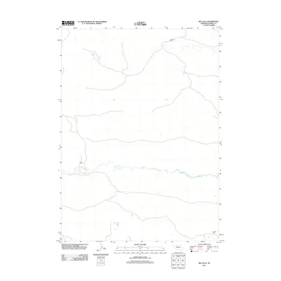
2011 Map of Big Falls
USGS Topo · Published 2011About this map
The North Loup River winds across this section of Cherry County, defining a landscape marked by isolated ranching outposts and sudden riverine features. The waterway's path is punctuated by Big Falls and Horseshoe Falls, providing rare points of topographical interest in the expansive Nebraska Sandhills. This 2011 survey documents a sparse settlement pattern where large-scale landholdings are the primary markers of human activity. Landmarks such as Wolfenden Ranch in the north and Emmons Ranch in the southeast reflect the enduring agricultural character of the region. Carrier Camp sits near the river's edge, highlighting the few established sites where the rugged terrain meets the water. The map's sparse road network and scattered water bodies illustrate the isolation of this remote prairie environment.
Find a feature on this map
6 named features on this map. Tap any name to fly to it.
Don’t see what you’re looking for? This feature index may not catch every label — zoom into the map to look around manually.
Map Details
Editions of this 2011 Big Falls Map
This is the sole edition of this map. No revisions or reprints were ever made.
Other maps of this area

1949 · Big Falls
USGS Topo · 1:62,500

1950 · Powderhorn Valley
USGS Topo · 1:62,500

1950 · Doughboy
USGS Topo · 1:62,500

1950 · Wolf Lake
USGS Topo · 1:62,500

1951 · Big Falls
USGS Topo · 1:62,500

1951 · Wolf Lake
USGS Topo · 1:62,500

1952 · Doughboy
USGS Topo · 1:62,500

1957 · Valentine
USGS Topo · 1:250,000

1959 · Valentine
USGS Topo · 1:250,000

1985 · Powderhorn Valley SW
USGS Topo · 1:24,000