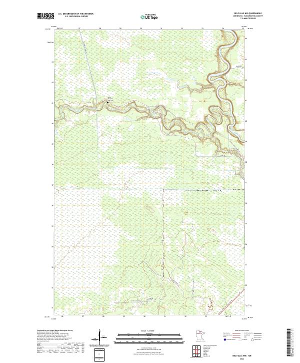
2022 Map of Big Falls NW
USGS Topo · Published 2022About this map
Meandering watercourses define this Koochiching County landscape, where the Big Fork River and Sturgeon River weave through extensive wetlands and timberland. The map provides a look at modern forestry and recreational access, featuring the Blue Ox State Trail MS84 029 Trl cutting through the southern sections. Local history is anchored by the Lower Sturgeon River Cem, situated on a bend of the Sturgeon River north of Co Rd 30. The network of timber and access roads, including Hickes Ridge Rd and Westrom Forest Rd, reflects the area's ongoing connection to the north woods' natural resources. Small tributaries like Ostby Cr feed into the larger river systems, which historically served as the primary transit corridors through these dense Minnesota lowlands.
Find a feature on this map
16 named features on this map. Tap any name to fly to it.
Don’t see what you’re looking for? This feature index may not catch every label — zoom into the map to look around manually.
Map Details
Editions of this 2022 Big Falls NW Map
This is the sole edition of this map. No revisions or reprints were ever made.
Other maps of this area

1919 · Lundgren
USGS Topo · 1:62,500

1919 · I
USGS Topo · 1:62,500

1919 · Margie
USGS Topo · 1:62,500

1943 · Lindford
USGS Topo · 1:62,500

1954 · Roseau
USGS Topo · 1:250,000

1954 · International Falls
USGS Topo · 1:250,000

1957 · Roseau
USGS Topo · 1:250,000

1957 · International Falls
USGS Topo · 1:250,000

1958 · International Falls
USGS Topo · 1:250,000

1958 · Roseau
USGS Topo · 1:250,000