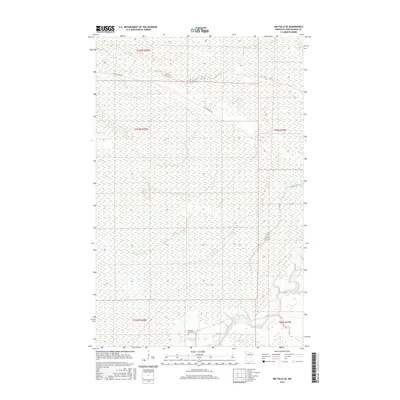
2016 Map of Big Falls SE
USGS Topo · Published 2016About this map
Big Fork River meanders through this portion of Koochiching County, cutting a winding path through the wetland-heavy terrain of northern Minnesota. This landscape is defined by its drainage patterns and the presence of the Caldwell Brook Cem, a key landmark for genealogical researchers in this area. Access through the dense northern woods is facilitated by Porter Ridge Rd, which serves as one of the primary terrestrial arteries in a region dominated by water and timberland. The map provides a look at the precise township and range boundaries, including t153n r25w and t64n r27w, illustrating the geometric surveying of this wilderness tract near the Canadian border.
Find a feature on this map
8 named features on this map. Tap any name to fly to it.
Don’t see what you’re looking for? This feature index may not catch every label — zoom into the map to look around manually.
Map Details
Editions of this 2016 Big Falls SE Map
This is the sole edition of this map. No revisions or reprints were ever made.
Other maps of this area

1918 · Zora
USGS Topo · 1:62,500

1919 · Zora
USGS Topo · 1:62,500

1919 · M
USGS Topo · 1:62,500

1919 · Margie
USGS Topo · 1:62,500

1954 · Hibbing
USGS Topo · 1:250,000

1954 · International Falls
USGS Topo · 1:250,000

1957 · Hibbing
USGS Topo · 1:250,000

1957 · International Falls
USGS Topo · 1:250,000

1958 · International Falls
USGS Topo · 1:250,000

1958 · Hibbing
USGS Topo · 1:250,000