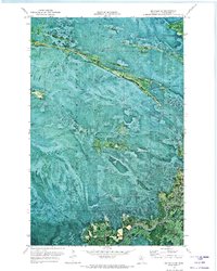
1970 Map of Big Falls SE
USGS Topo · Published 1973About this map
Pine Island State Forest dominates this 1970 orthophotomap of northern Minnesota, revealing a landscape defined by the dense vegetation and drainage patterns of Koochiching County. The use of aerial photography from 1969 and 1970 provides a literal view of the forest floor, contrasting the wilder sections of the state forest with the established corridors of the Winter Trail that cut through the terrain. A small, solitary Cem stands as a quiet marker of local history, offering a rare point of human interest in an area otherwise characterized by vast stretches of timber and natural features. This specific survey type highlights the transition in mapping techniques, where high-altitude photogrammetry allows for a precise study of land use and timber management during the early 1970s.
Find a feature on this map
7 named features on this map. Tap any name to fly to it.
Don’t see what you’re looking for? This feature index may not catch every label — zoom into the map to look around manually.
Map Details
Editions of this 1970 Big Falls SE Map
This is the sole edition of this map. No revisions or reprints were ever made.
Other maps of this area

1918 · Zora
USGS Topo · 1:62,500

1919 · Zora
USGS Topo · 1:62,500

1919 · M
USGS Topo · 1:62,500

1919 · Margie
USGS Topo · 1:62,500

1954 · Hibbing
USGS Topo · 1:250,000

1954 · International Falls
USGS Topo · 1:250,000

1957 · Hibbing
USGS Topo · 1:250,000

1957 · International Falls
USGS Topo · 1:250,000

1958 · International Falls
USGS Topo · 1:250,000

1958 · Hibbing
USGS Topo · 1:250,000