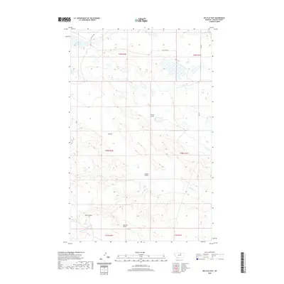
2020 Map of Big Flat East
USGS Topo · Published 2020About this map
Big Flat characterizes this portion of Phillips County, defined by its extensive drainage systems and prairie topography. The northern reaches of the map feature Weigand Reservoir, which collects water near Mud Cr. The land is deeply etched by numerous seasonal watercourses and coulees, including Tressler Coulee, Chicken Coulee, and Sage Hen Coulee. Transport through this open landscape follows historic paths and modern infrastructure alike, with the evocative Stage Coach Rd and Hwy 204 providing the primary transit north of Wild Horse Cr. The map captures a transition where the high flatland gives way to the complex, eroded drainages of Rocky Coulee, illustrating the agricultural and hydraulic management of this Montana district.
Find a feature on this map
16 named features on this map. Tap any name to fly to it.
Don’t see what you’re looking for? This feature index may not catch every label — zoom into the map to look around manually.
Map Details
Editions of this 2020 Big Flat East Map
This is the sole edition of this map. No revisions or reprints were ever made.
Other maps of this area

1953 · Havre
USGS Topo · 1:250,000

1957 · Havre
USGS Topo · 1:250,000

1958 · Havre
USGS Topo · 1:250,000

1964 · Coburg SE
USGS Topo · 1:24,000

1964 · Weigand Reservoir
USGS Topo · 1:24,000

1964 · Cow Creek
USGS Topo · 1:24,000

1965 · Phillips
USGS Topo · 1:24,000

1965 · Wild Horse Reservoir
USGS Topo · 1:24,000

1971 · Big Flat East
USGS Topo · 1:24,000
1971 · Ball Coulee
USGS Topo · 1:24,000