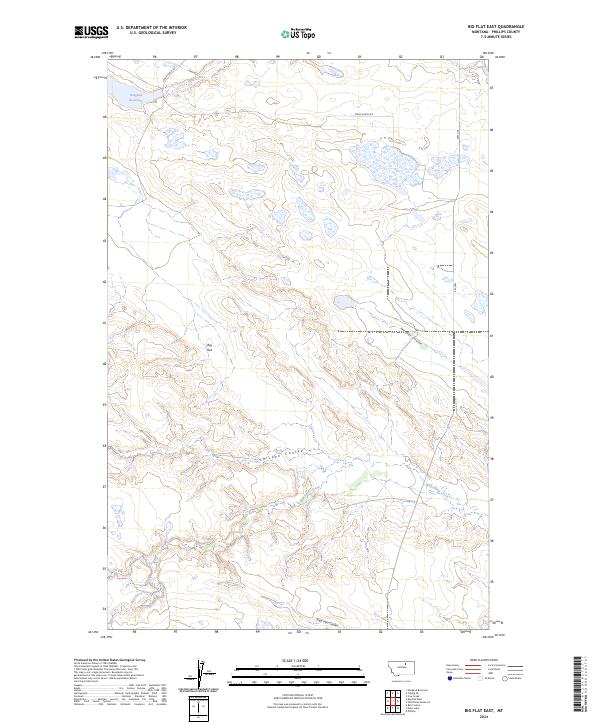
2024 Map of Big Flat East
USGS Topo · Published 2024About this map
Big Flat dominates this portion of Phillips County, Montana, characterized by a complex network of coulees and intermittent watercourses. The landscape is defined by the drainage patterns of Chicken Coulee, Tressler Coulee, and Sage Hen Coulee, which carve through the high plains toward larger bodies like Wild Horse Creek. A significant portion of the eastern section is dedicated to the Phillips County Waterfowl Production Area, highlighting the region's importance for migratory bird conservation amidst the arid terrain. Infrastructure is sparse, anchored by the north-south route of Hwy 204 and the evocative Stage Coach Rd near the northern boundary. In the northwest, the Weigand Reservoir near Mud Creek represents a vital water management feature in this agricultural and ranching environment.
Find a feature on this map
16 named features on this map. Tap any name to fly to it.
Don’t see what you’re looking for? This feature index may not catch every label — zoom into the map to look around manually.
Map Details
Editions of this 2024 Big Flat East Map
This is the sole edition of this map. No revisions or reprints were ever made.
Other maps of this area

1953 · Havre
USGS Topo · 1:250,000

1957 · Havre
USGS Topo · 1:250,000

1958 · Havre
USGS Topo · 1:250,000

1964 · Coburg SE
USGS Topo · 1:24,000

1964 · Weigand Reservoir
USGS Topo · 1:24,000

1964 · Cow Creek
USGS Topo · 1:24,000

1965 · Phillips
USGS Topo · 1:24,000

1965 · Wild Horse Reservoir
USGS Topo · 1:24,000

1971 · Big Flat East
USGS Topo · 1:24,000
1971 · Ball Coulee
USGS Topo · 1:24,000