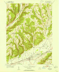
1953 Map of Big Flats
USGS Topo · Published 1964About this map
The Chemung River valley serves as a bustling corridor of mid-century transport and settlement in this 1953 study. The village of Big Flats is a central hub where the Lackawanna RR and Erie RR converge, illustrating the heavy industrial reliance on rail before the interstate era. This infrastructure supports the local economy alongside the County Airport situated near Fisherville.
Find a feature on this map
51 named features on this map. Tap any name to fly to it.
Don’t see what you’re looking for? This feature index may not catch every label — zoom into the map to look around manually.
Map Details
Editions of this 1953 Big Flats Map
2 editions found
Other maps of this area

1895 · Elmira
USGS Topo · 1:62,500

1898 · Watkins Glen
USGS Topo · 1:62,500

1901 · Watkins
USGS Topo · 1:62,500

1903 · Hammondsport
USGS Topo · 1:62,500

1905 · Watkins Glen
USGS Topo · 1:125,000

1914 · Corning
USGS Topo · 1:62,500

1944 · Corning
USGS Topo · 1:62,500

1950 · Elmira
USGS Topo · 1:250,000

1950 · Montour Falls
USGS Topo · 1:24,000

1953 · Bradford
USGS Topo · 1:24,000