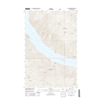
2014 Map of Big Goat Mountain
USGS Topo · Published 2014About this map
Chelan-Lucerne Ferry routes cross the waters of Lake Chelan in this high-altitude landscape of the Wenatchee National Forest. The topography is defined by the steep rise from the lake shore to significant summits including Uno Peak, Big Goat Mtn, and the Chelan Mountains. Numerous drainage creeks such as Ridge Cr, Nobby Cr, and Big Cr cut through the terrain, feeding into the lake at natural harbors. Recreational access is evidenced by a series of waterside and mountain sites, including the Graham Harbor and Corral Creek Campground facilities. The map also records distinctive landforms like Point No Point and the high Barney Zell Ridge, providing a clear look at the wilderness geography before more recent forest changes or administrative adjustments. This 2014 survey captures the precise relationship between the lake’s transportation network and the surrounding peaks.
Find a feature on this map
33 named features on this map. Tap any name to fly to it.
Don’t see what you’re looking for? This feature index may not catch every label — zoom into the map to look around manually.
Map Details
Editions of this 2014 Big Goat Mountain Map
This is the sole edition of this map. No revisions or reprints were ever made.
Other maps of this area

1899 · Methow
USGS Topo · 1:125,000

1901 · Chelan
USGS Topo · 1:125,000

1901 · Methow
USGS Topo · 1:125,000

1901 · Chiwaukum
USGS Topo · 1:125,000

1902 · Stehekin
USGS Topo · 1:125,000

1904 · Stehekin
USGS Topo · 1:125,000

1904 · Chiwaukum
USGS Topo · 1:125,000

1944 · Lucerne
USGS Topo · 1:62,500

1949 · Lucerne
USGS Topo · 1:62,500

1955 · Concrete
USGS Topo · 1:250,000