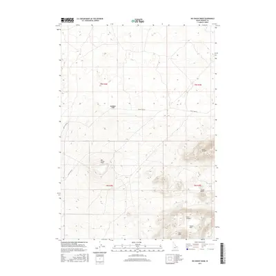
2017 Map of Big Grassy Ridge
USGS Topo · Published 2017About this map
Big Grassy Ridge defines the volcanic landscape of this portion of Fremont County, where the high desert terrain of eastern Idaho rises into significant landforms. The area is dominated by the Juniper Buttes complex, which includes distinct elevations such as the North Junipers, South Junipers, and West Butte. This 2017 survey reveals a remote landscape primarily utilized for grazing and transit, as evidenced by the presence of Jenkins Will and the long arterial routes of Grassy Ridge Rd and 18 Days Lake Rd. The mapping of Hansen Basin further illustrates the complex depressions and rises typical of this basalt-strewn region, providing a clear record of the area's geography before shifting environmental or land-use patterns alter the character of these high-plateau features.
Find a feature on this map
13 named features on this map. Tap any name to fly to it.
Don’t see what you’re looking for? This feature index may not catch every label — zoom into the map to look around manually.
Map Details
Editions of this 2017 Big Grassy Ridge Map
This is the sole edition of this map. No revisions or reprints were ever made.
Other maps of this area

1948 · Parker
USGS Topo · 1:24,000

1950 · Parker
USGS Topo · 1:24,000

1951 · Plano
USGS Topo · 1:24,000

1955 · Dubois
USGS Topo · 1:250,000

1955 · Idaho Falls
USGS Topo · 1:250,000

1955 · Ashton
USGS Topo · 1:250,000

1955 · Driggs
USGS Topo · 1:250,000

1958 · Driggs
USGS Topo · 1:250,000

1958 · Dubois
USGS Topo · 1:250,000

1958 · Idaho Falls
USGS Topo · 1:250,000