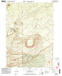
2004 Map of Big Hole
USGS Topo · Published 2007About this map
Summit Stage Station (Site) marks a point of historical transit along the western edge of this volcanic landscape, where the high desert meets the wooded slopes of the southern Oregon Cascades. The topography is dominated by the massive depression of the Big Hole (Dry Flat), a significant geologic feature surrounded by volcanic peaks such as Big Hole Butte and Katati Butte. This 2004 revision by the USDA Forest Service highlights the intersection of the Deschutes National Forest and Fremont National Forest, showing a region managed for both wildlife conservation and recreation. The Cabin Lake Wildlife Area covers the central terrain, while the Outback Scenic Byway provides the primary corridor for modern travel through this sparsely populated boundary between Klamath and Lake counties.
Find a feature on this map
15 named features on this map. Tap any name to fly to it.
Don’t see what you’re looking for? This feature index may not catch every label — zoom into the map to look around manually.
Map Details
Editions of this 2004 Big Hole Map
This is the sole edition of this map. No revisions or reprints were ever made.
Other maps of this area

1931 · Newberry Crater
USGS Topo · 1:125,000

1935 · Newberry Crater
USGS Topo · 1:125,000

1955 · Crescent
USGS Topo · 1:250,000

1957 · Crescent
USGS Topo · 1:250,000

1958 · Crescent
USGS Topo · 1:250,000
1963 · Spring Butte
USGS Topo · 1:24,000
1963 · Moffitt Butte
USGS Topo · 1:24,000

1970 · Crescent
USGS Topo · 1:250,000

1979 · Crescent
USGS Topo · 1:100,000
1981 · Wickiup Spring
USGS Topo · 1:24,000