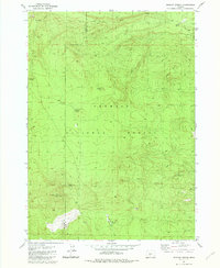
1981 Map of Wickiup Spring
USGS Topo · Published 1982About this map
Wickiup Spring and a remote Forest Service Sta mark this high-elevation landscape within the Fremont National Forest during the late 1970s. The terrain is defined by volcanic features and significant relief, ranging from the prominent Bald Mountain with its established Lookout to the distinctive Wastina Butte and Wickiup Butte. Water sources are critical in this arid environment, evidenced by the numerous named springs including Trapper Spring, Smoke Creek Spring, and Mush Spring.
Find a feature on this map
21 named features on this map. Tap any name to fly to it.
Don’t see what you’re looking for? This feature index may not catch every label — zoom into the map to look around manually.
Map Details
Editions of this 1981 Wickiup Spring Map
This is the sole edition of this map. No revisions or reprints were ever made.
Other maps of this area

1955 · Crescent
USGS Topo · 1:250,000

1957 · Crescent
USGS Topo · 1:250,000

1958 · Crescent
USGS Topo · 1:250,000

1968 · Location Butte
USGS Topo · 1:24,000

1968 · Oatman Flat
USGS Topo · 1:24,000
1968 · Antelope Mtn
USGS Topo · 1:24,000

1970 · Crescent
USGS Topo · 1:250,000

1979 · Crescent
USGS Topo · 1:100,000
1981 · Stams Mtn
USGS Topo · 1:24,000
1982 · Grass Well
USGS Topo · 1:24,000