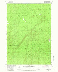
1982 Map of Grass Well
USGS Topo · Published 1982About this map
Deschutes National Forest, Winema National Forest, and Fremont National Forest converge on this high-desert plateau in Klamath County, Oregon. This 1982 map shows a landscape defined by forest management and resource extraction, where the National Forest Boundary separates these major federal holdings. The terrain is marked by the presence of a Borrow Pit, indicating local road maintenance or construction needs within the timberlands, while Grass Well serves as a vital water source in an otherwise arid expanse. The dense network of unimproved roads and four-wheel-drive tracks suggests the area's primary use for forest service access and land management rather than residential settlement.
Find a feature on this map
6 named features on this map. Tap any name to fly to it.
Don’t see what you’re looking for? This feature index may not catch every label — zoom into the map to look around manually.
Map Details
Editions of this 1982 Grass Well Map
This is the sole edition of this map. No revisions or reprints were ever made.
Other maps of this area

1930 · Maiden Peak
USGS Topo · 1:125,000

1931 · Newberry Crater
USGS Topo · 1:125,000

1934 · Maiden Peak
USGS Topo · 1:125,000

1935 · Chemult
USGS Topo · 1:96,000

1935 · Newberry Crater
USGS Topo · 1:125,000

1941 · Chemult
USGS Topo · 1:125,000

1955 · Crescent
USGS Topo · 1:250,000

1957 · Crescent
USGS Topo · 1:250,000

1958 · Crescent
USGS Topo · 1:250,000

1963 · Masten Butte
USGS Topo · 1:24,000