
1968 Map of Oatman Flat
USGS Topo · Published 1971About this map
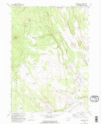
Fremont National Forest dominates this section of Lake County, where high-desert terrain is marked by essential water sources like North Willow Spring, Baskin Spring, and the Meadow Waterhole. The map illustrates a landscape of high-altitude flats and volcanic peaks, featuring the prominent Oatman Flat and the curiously named Devils Ball Diamond. Small-scale industry and habitation appear in the form of a Cinder Pit and isolated dwellings such as Wing Butte Cabin and the Stratton Place.
Find a feature on this map
26 named features on this map. Tap any name to fly to it.
Don’t see what you’re looking for? This feature index may not catch every label — zoom into the map to look around manually.
Map Details
Editions of this 1968 Oatman Flat Map
2 editions found
Other maps of this area

1955 · Crescent
USGS Topo · 1:250,000

1957 · Crescent
USGS Topo · 1:250,000

1958 · Crescent
USGS Topo · 1:250,000

1968 · Silver Lake
USGS Topo · 1:24,000

1968 · Rodman Rock
USGS Topo · 1:24,000
1968 · Hager Mtn
USGS Topo · 1:24,000
1968 · Antelope Mtn
USGS Topo · 1:24,000
1968 · Bridge Creek Draw
USGS Topo · 1:24,000

1970 · Crescent
USGS Topo · 1:250,000

1979 · Crescent
USGS Topo · 1:100,000