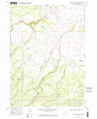
1968 Map of Bridge Creek Draw
USGS Topo · Published 1972About this map
Fremont National Forest defines the character of this high-desert landscape in Lake County, where scattered ranching outposts like Howard Ranch and Freeman Ranch established a presence along the drainages. The map reveals a land managed for both resource extraction and conservation, marked by numerous water sources such as Lundy Spring and South Spring, alongside the McBroom Administrative Study Plot. A distinct Treaty Boundary cuts across the southern sections, intersecting the path of Indian Creek. Transportation is dominated by a network of Jeep Trails and the primary Silver Lake Road, connecting isolated features like Buck Creek Crossing to the broader region. The presence of several Gravel Pits and a Cinder Pit suggests local industry geared toward road maintenance or land development during this late 1960s era.
Find a feature on this map
41 named features on this map. Tap any name to fly to it.
Don’t see what you’re looking for? This feature index may not catch every label — zoom into the map to look around manually.
Map Details
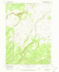
Editions of this 1968 Bridge Creek Draw Map
2 editions found
Other maps of this area

1889 · Klamath
USGS Topo · 1:250,000

1894 · Klamath
USGS Topo · 1:250,000

1955 · Crescent
USGS Topo · 1:250,000

1955 · Klamath Falls
USGS Topo · 1:250,000

1957 · Crescent
USGS Topo · 1:250,000

1958 · Crescent
USGS Topo · 1:250,000

1958 · Klamath Falls
USGS Topo · 1:250,000

1960 · Sycan Marsh
USGS Topo · 1:62,500

1960 · Yamsay Mountain
USGS Topo · 1:62,500

1968 · Silver Lake
USGS Topo · 1:24,000