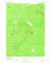
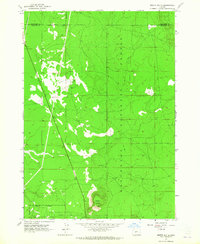
1963 Map of Spring Butte
USGS Topo · Published 1965About this map
Deschutes National Forest spans this high desert landscape, defined by a series of volcanic features and sparse watering points in the early 1960s. The terrain is dominated by prominent cinder cones including Spring Butte, Green Butte, and Ipswoot Butte, which provided vital vantage points for fire lookouts like the one at Lookout Spring Butte. The presence of a Cinder Pit near Sand Flat indicates localized mineral extraction, likely for road surfacing or construction materials in this remote section of the Oregon Cascades. Regional infrastructure is limited to the Jones Well Guard Station and a network of unimproved routes, with water resources such as the Spring Butte Well and Jones Well serving as essential markers for Forest Service operations and range management. This map documents a quiet, utilitarian era of public land administration where three county lines converge amidst a vast stretch of lodgepole and volcanic soil.
Find a feature on this map
16 named features on this map. Tap any name to fly to it.
Don’t see what you’re looking for? This feature index may not catch every label — zoom into the map to look around manually.
Map Details
Editions of this 1963 Spring Butte Map
2 editions found
Other maps of this area

1931 · Newberry Crater
USGS Topo · 1:125,000

1935 · Newberry Crater
USGS Topo · 1:125,000

1955 · Crescent
USGS Topo · 1:250,000

1957 · Crescent
USGS Topo · 1:250,000

1958 · Crescent
USGS Topo · 1:250,000
1963 · Finley Butte
USGS Topo · 1:24,000
1963 · Paulina Peak
USGS Topo · 1:24,000
1963 · Moffitt Butte
USGS Topo · 1:24,000

1970 · Crescent
USGS Topo · 1:250,000
1974 · Newberry Crater 4 NW
USGS Topo · 1:24,000