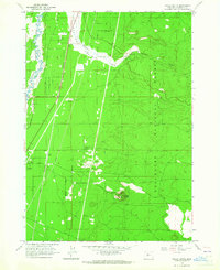
1963 Map of Finley Butte
USGS Topo · Published 1965About this map
The Little Deschutes River meanders along the western edge of this landscape, where the settlement of La Pine serves as a small hub for the surrounding timber and transit corridor. Bisected by the Great Northern railroad and the La Pine Siding, the area shows a clear reliance on rail transport and logging infrastructure within the Deschutes National Forest. Notable landmarks like Finley Butte rise above the terrain, while the broad expanse of Paulina Prairie is defined by the flow of Paulina Creek. Researchers will find local history preserved at the Improved Order of Redmen Cemetery and another smaller Cem near Prairie Campground. The presence of several Gravel Pit and Cinder Pit locations alongside the Pipeline suggests an era of active resource extraction and infrastructure development during the early 1960s.
Find a feature on this map
20 named features on this map. Tap any name to fly to it.
Don’t see what you’re looking for? This feature index may not catch every label — zoom into the map to look around manually.
Map Details
Editions of this 1963 Finley Butte Map
2 editions found
Other maps of this area

1930 · Maiden Peak
USGS Topo · 1:125,000

1931 · Newberry Crater
USGS Topo · 1:125,000

1934 · Maiden Peak
USGS Topo · 1:125,000

1935 · Newberry Crater
USGS Topo · 1:125,000

1955 · Crescent
USGS Topo · 1:250,000

1957 · Crescent
USGS Topo · 1:250,000

1958 · Crescent
USGS Topo · 1:250,000
1963 · Lava Cast Forest
USGS Topo · 1:24,000
1963 · Anns Butte
USGS Topo · 1:24,000

1963 · La Pine
USGS Topo · 1:24,000