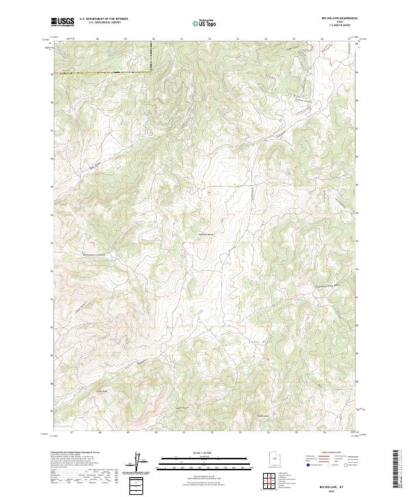
2023 Map of Big Hollow
USGS Topo · Published 2023About this map
The Wasatch Range dominates this landscape along the boundary of Juab Co and Sanpete Co, where complex drainages like Big Hollow and Wood Hollow carve through the high terrain. The topography is defined by significant elevations such as Rollys Peak and the rolling Cedar Hills, with a network of water features including Whitaker Springs and House Spring providing vital points of interest in an otherwise arid environment.
Find a feature on this map
25 named features on this map. Tap any name to fly to it.
Don’t see what you’re looking for? This feature index may not catch every label — zoom into the map to look around manually.
Map Details
Editions of this 2023 Big Hollow Map
This is the sole edition of this map. No revisions or reprints were ever made.
Other maps of this area

1885 · Manti
USGS Topo · 1:250,000

1895 · Manti
USGS Topo · 1:250,000

1951 · Moroni
USGS Topo · 1:62,500

1952 · Santaquin Peak
USGS Topo · 1:62,500

1956 · Price
USGS Topo · 1:250,000

1960 · Price
USGS Topo · 1:250,000

1962 · Price
USGS Topo · 1:250,000
1967 · Indianola
USGS Topo · 1:24,000
1967 · Mount Pleasant
USGS Topo · 1:24,000
1967 · Fairview
USGS Topo · 1:24,000