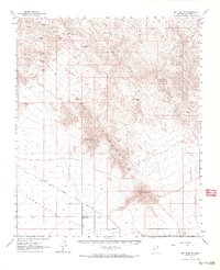
1961 Map of Big Horn Mts
USGS Topo · Published 1968About this map
Mining operations and ranching outposts define this arid landscape during the early 1960s. The northern reaches of the quadrangle are heavily marked by historic mining activity, including the Mollie Davenport Mine, El Tigre Mine, and Gold Bullion Mine, indicating a period of intense mineral exploration. To the south, the topography flattens into the Harquahala Plain, where the presence of the Mary E Ranch and Blecha Ranch suggests the importance of cattle ranching in this desert environment. Centered on the map, the Big Horn Mountains rise sharply, anchored by Big Horn Peak and Burnt Mountain. Transportation in this era relied on the Buckeye Salome Road and a solitary Airstrip near the settlement of Pleasanton. This survey preserves a transition from rugged mineral extraction to wide-open rangeland, providing a clear record of land use before modern developments.
Find a feature on this map
36 named features on this map. Tap any name to fly to it.
Don’t see what you’re looking for? This feature index may not catch every label — zoom into the map to look around manually.
Map Details
Editions of this 1961 Big Horn Mts Map
3 editions found
Other maps of this area

1942 · Vicksburg
USGS Topo · 1:250,000

1954 · Phoenix
USGS Topo · 1:250,000

1957 · Phoenix
USGS Topo · 1:250,000

1958 · Phoenix
USGS Topo · 1:250,000

1960 · Phoenix
USGS Topo · 1:250,000

1961 · Lone Mountain
USGS Topo · 1:62,500

1961 · Vulture Mountains
USGS Topo · 1:62,500

1961 · Big Horn Mts
USGS Topo · 1:62,500

1961 · Gladden
USGS Topo · 1:62,500

1962 · Belmont Mts
USGS Topo · 1:62,500