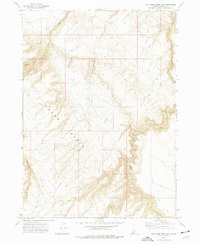
1972 Map of Big Horse Basin Gap
USGS Topo · Published 1976About this map
Horse Basin defines this high-desert landscape in Owyhee County, characterized by a series of dramatic gaps and drainage networks captured during a 1972 field check. The area is marked by the convergence of Big Horse Basin Gap and Little Horse Basin Gap, which provide natural passage through the high terrain. Water management and seasonal flow are evident through the paths of Big Jacks Creek and Little Jacks Creek, as well as Rattlesnake Creek to the southwest.
Find a feature on this map
11 named features on this map. Tap any name to fly to it.
Don’t see what you’re looking for? This feature index may not catch every label — zoom into the map to look around manually.
Map Details
Editions of this 1972 Big Horse Basin Gap Map
This is the sole edition of this map. No revisions or reprints were ever made.
Other maps of this area

1947 · Little Valley
USGS Topo · 1:24,000

1947 · Grand View
USGS Topo · 1:62,500

1947 · Bruneau
USGS Topo · 1:62,500

1947 · Chalk Hills
USGS Topo · 1:24,000

1947 · Perjue Canyon
USGS Topo · 1:24,000

1948 · Perjue Canyon
USGS Topo · 1:24,000
1948 · Little Valley
USGS Topo · 1:24,000
1948 · Chalk Hills
USGS Topo · 1:24,000

1955 · Jordan Valley
USGS Topo · 1:250,000

1955 · Twin Falls
USGS Topo · 1:250,000