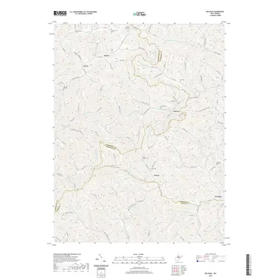
2019 Map of Big Isaac
USGS Topo · Published 2019About this map
Big Isaac sits at the convergence of Big Isaac Cr and Laurel Run, serving as a central point in this deeply dissected Appalachian landscape. The terrain is characterized by a dense network of winding hollows and ridges, which have historically dictated the placement of small communities and the winding routes of county roads like Co Rte 35 and Co Rte 15. The map documents a scattered settlement pattern typical of West Virginia's interior, where hamlets like Miletus, Zinnia, and Benson are connected by a web of rural routes. Numerous burial grounds, including Greenbrier Cem, Mount Lebanon Cem, and the high-elevation Mount Carmel Cem, provide significant genealogical markers across the hills. The presence of Gas Well RD indicates the ongoing role of resource extraction in the local economy, while the triple boundary of Doddridge Co, Harrison Co, and Lewis Co highlights the complex administrative geography of the region.
Find a feature on this map
104 named features on this map. Tap any name to fly to it.
Don’t see what you’re looking for? This feature index may not catch every label — zoom into the map to look around manually.
Map Details
Editions of this 2019 Big Isaac Map
This is the sole edition of this map. No revisions or reprints were ever made.
Other maps of this area

1902 · Clarksburg
USGS Topo · 1:62,500

1904 · Weston
USGS Topo · 1:62,500

1904 · Vadis
USGS Topo · 1:62,500

1905 · Centerpoint
USGS Topo · 1:62,500

1910 · Clarksburg
USGS Topo · 1:62,500

1923 · Clarksburg
USGS Topo · 1:62,500

1924 · Centerpoint
USGS Topo · 1:62,500

1925 · Clarksburg
USGS Topo · 1:62,500

1925 · Centerpoint
USGS Topo · 1:62,500

1925 · Vadis
USGS Topo · 1:62,500