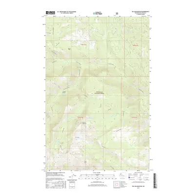
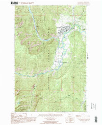
2017 Map of Big Jim Mountain
USGS Topo · Published 2017About this map
Big Jim Mountain and the high elevations of the Wenatchee National Forest dominate this 2017 survey of the Cascade Range. The landscape is defined by the sharp prominence of Icicle Ridge and McCue Ridge, which shelter a series of high-altitude alpine basins. This area is a significant drainage divide for the regional watershed, with numerous cold-water sources such as Chiwaukum Creek, Painter Creek, and Hatchery Creek flowing from the rocky heights. A cluster of secluded water bodies including Lake Augusta, Lake Ida, Loch Eileen, and Lake Julius dot the terrain, illustrating the glacial carving of the peaks. Unusual geological formations are noted at the Badlands, while Timothy Meadow provides one of the few named clearings in the dense forest cover.
Find a feature on this map
39 named features on this map. Tap any name to fly to it.
Don’t see what you’re looking for? This feature index may not catch every label — zoom into the map to look around manually.
Map Details
Editions of this 2017 Big Jim Mountain Map
This is the sole edition of this map. No revisions or reprints were ever made.
Other maps of this area

1901 · Chiwaukum
USGS Topo · 1:125,000

1904 · Chiwaukum
USGS Topo · 1:125,000

1957 · Wenatchee
USGS Topo · 1:250,000

1964 · Leavenworth
USGS Topo · 1:62,500

1965 · Chiwaukum Mts
USGS Topo · 1:62,500

1965 · Wenatchee Lake
USGS Topo · 1:62,500
1968 · Plain
USGS Topo · 1:24,000
1975 · Chelan
USGS Topo · 1:100,000
1989 · Big Jim Mountain
USGS Topo · 1:24,000
1989 · Leavenworth
USGS Topo · 1:24,000