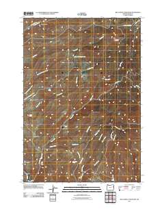
2011 Map of Big Lookout Mountain
USGS Topo · Published 2011About this map
Big Lookout Mountain dominates this rugged high-desert landscape in Eastern Oregon, serving as the hydrological centerpiece for a complex network of drainages. The area is defined by its deep canyons and named gulches, including Gold Cliff Gulch, Pearce Gulch, and Drindarry Gulch, which suggest a history of prospecting and resource extraction. A series of critical water sources, such as Hawks Nest Spring, Mud Spring, and Barnes Spring, punctuate the arid terrain, providing vital relief in a region where seasonal flows like Gold Creek and the North Fork Swayze Creek carve through the earth. Connectivity across this high-altitude terrain is maintained through primitive routes like Lookout Mountain Rd and Sisley Creek Rd, tracing the ridgelines and creek beds that lead toward the Burn River in the south.
Find a feature on this map
30 named features on this map. Tap any name to fly to it.
Don’t see what you’re looking for? This feature index may not catch every label — zoom into the map to look around manually.
Map Details
Editions of this 2011 Big Lookout Mountain Map
This is the sole edition of this map. No revisions or reprints were ever made.
Other maps of this area

1915 · Pine
USGS Topo · 1:125,000

1951 · Huntington
USGS Topo · 1:62,500

1952 · Olds Ferry NW
USGS Topo · 1:24,000

1952 · Olds Ferry
USGS Topo · 1:62,500

1955 · Baker
USGS Topo · 1:250,000

1957 · Durkee
USGS Topo · 1:62,500

1957 · Mineral
USGS Topo · 1:62,500

1959 · Baker
USGS Topo · 1:250,000

1980 · Brogan
USGS Topo · 1:100,000

1981 · Baker
USGS Topo · 1:100,000