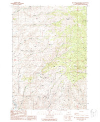
1988 Map of Big Lookout Mountain
USGS Topo · Published 1988About this map
Big Lookout Mountain dominates the northern reaches of this Baker County landscape, casting a shadow over a complex network of drainages and early mining prospects. In the late 1980s, the terrain south of the peak reveals a history of extraction, particularly concentrated along Gold Gulch and the slopes of the Hogback. The small settlement of Weatherby sits in the southwestern corner near the Burnt River, while family-named sites like Nelson Place suggest a pattern of isolated mountain habitation. Numerous mines, mineshafts, and prospects are peppered throughout the southern gulches, including Raster Gulch and Drindarry Gulch, indicating a landscape heavily scrutinized for mineral wealth. The drainage systems of Swayze Creek and Jordan Creek carve through the high country, providing essential water sources in this elevated environment.
Find a feature on this map
41 named features on this map. Tap any name to fly to it.
Don’t see what you’re looking for? This feature index may not catch every label — zoom into the map to look around manually.
Map Details
Editions of this 1988 Big Lookout Mountain Map
This is the sole edition of this map. No revisions or reprints were ever made.
Other maps of this area

1915 · Pine
USGS Topo · 1:125,000

1951 · Huntington
USGS Topo · 1:62,500

1952 · Olds Ferry NW
USGS Topo · 1:24,000

1952 · Olds Ferry
USGS Topo · 1:62,500

1955 · Baker
USGS Topo · 1:250,000

1957 · Durkee
USGS Topo · 1:62,500

1957 · Mineral
USGS Topo · 1:62,500

1959 · Baker
USGS Topo · 1:250,000

1980 · Brogan
USGS Topo · 1:100,000

1981 · Baker
USGS Topo · 1:100,000