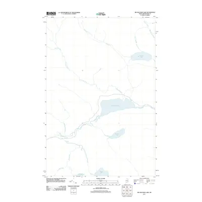
2011 Map of Big Machias Lake
USGS Topo · Published 2011About this map
Big Machias Lake and its surrounding network of waterways define this corner of Aroostook County, Maine. The landscape is a complex system of drainage where Twentymile Brook and West Inlet feed into the central lakes, eventually flowing into the Machias River and Pratt Lake Stream. This hydrological pattern is characteristic of the North Woods, where timber management and recreation are the primary drivers of human movement. Evidence of this modern land use is visible via Realty Rd, a private logging thoroughfare that provides access to the remote interior. Further south, smaller bodies of water like McGowan Lake, BillingsPond, and Rowe Lake sit amid a terrain crisscrossed by minor tributaries such as Billings Brook and Ingalls Brook.
Find a feature on this map
14 named features on this map. Tap any name to fly to it.
Don’t see what you’re looking for? This feature index may not catch every label — zoom into the map to look around manually.
Map Details
Editions of this 2011 Big Machias Lake Map
This is the sole edition of this map. No revisions or reprints were ever made.
Other maps of this area

1928 · Winterville
USGS Topo · 1:48,000

1930 · Greenlaw
USGS Topo · 1:48,000

1931 · Fish River Lake
USGS Topo · 1:48,000

1931 · Mooseleuk Lake
USGS Topo · 1:48,000

1931 · Winterville
USGS Topo · 1:62,500

1933 · Greenlaw
USGS Topo · 1:62,500

1935 · Fish River Lake
USGS Topo · 1:62,500

1935 · Mooseleuk Lake
USGS Topo · 1:62,500

1954 · Presque Isle
USGS Topo · 1:250,000

1958 · Presque Isle
USGS Topo · 1:250,000