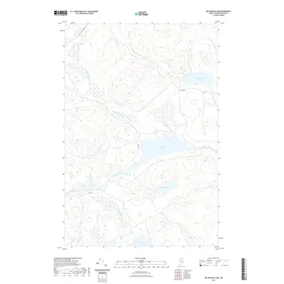
2021 Map of Big Machias Lake
USGS Topo · Published 2021About this map
Big Machias Lake dominates the central landscape of this Aroostook County backcountry, serving as the focal point for a complex network of waterways including the Machias River and Twentymile Brook. The terrain is defined by its drainage patterns, with W Inlet and Clayton Stream feeding into Clayton Lake to the north, while the southern reaches are marked by McGowan Lake and Rowe Lake. This 2021 survey reveals a territory primarily accessed by industrial and timber management routes such as Realty Rd and Carr Pond Rd. The presence of labels like Twenty Mile Country reflects the enduring nomenclature of the Maine North Woods, where geographic distance and natural landmarks historically dictated navigation and land use in the absence of traditional townships.
Find a feature on this map
16 named features on this map. Tap any name to fly to it.
Don’t see what you’re looking for? This feature index may not catch every label — zoom into the map to look around manually.
Map Details
Editions of this 2021 Big Machias Lake Map
This is the sole edition of this map. No revisions or reprints were ever made.
Other maps of this area

1928 · Winterville
USGS Topo · 1:48,000

1930 · Greenlaw
USGS Topo · 1:48,000

1931 · Fish River Lake
USGS Topo · 1:48,000

1931 · Mooseleuk Lake
USGS Topo · 1:48,000

1931 · Winterville
USGS Topo · 1:62,500

1933 · Greenlaw
USGS Topo · 1:62,500

1935 · Fish River Lake
USGS Topo · 1:62,500

1935 · Mooseleuk Lake
USGS Topo · 1:62,500

1954 · Presque Isle
USGS Topo · 1:250,000

1958 · Presque Isle
USGS Topo · 1:250,000