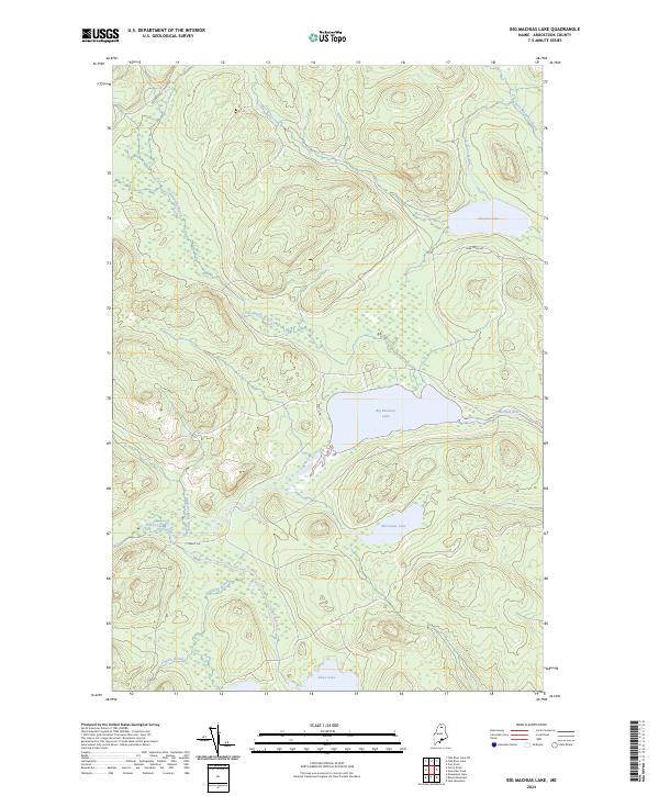
2024 Map of Big Machias Lake
USGS Topo · Published 2024About this map
Big Machias Lake sits at the center of this hydrographic landscape in Northern Maine, serving as a primary basin for the Machias River. The terrain is defined by a dense network of waterways including Twentymile Brook and West Inlet, which drain the surrounding highlands into larger bodies like Clayton Lake. This region remains largely characterized by its timberland geography, where industrial access is provided via Realty Rd and Carr Pond Rd. Smaller basins like Rowe Lake and McGowan Lake dot the southern and eastern quadrants, illustrating the glacial drainage patterns typical of Aroostook County. The map captures a moment in the modern management of these North Woods resources, showing the connection between established logging routes and the pristine flow of Pratt Lake Stream.
Find a feature on this map
15 named features on this map. Tap any name to fly to it.
Don’t see what you’re looking for? This feature index may not catch every label — zoom into the map to look around manually.
Map Details
Editions of this 2024 Big Machias Lake Map
This is the sole edition of this map. No revisions or reprints were ever made.
Other maps of this area

1928 · Winterville
USGS Topo · 1:48,000

1930 · Greenlaw
USGS Topo · 1:48,000

1931 · Fish River Lake
USGS Topo · 1:48,000

1931 · Mooseleuk Lake
USGS Topo · 1:48,000

1931 · Winterville
USGS Topo · 1:62,500

1933 · Greenlaw
USGS Topo · 1:62,500

1935 · Fish River Lake
USGS Topo · 1:62,500

1935 · Mooseleuk Lake
USGS Topo · 1:62,500

1954 · Presque Isle
USGS Topo · 1:250,000

1958 · Presque Isle
USGS Topo · 1:250,000