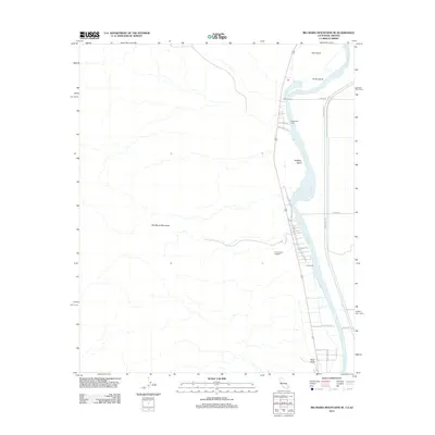
2012 Map of Big Maria Mountains SE
USGS Topo · Published 2012About this map
The Colorado River defines the eastern boundary of this landscape, carving through the desert terrain as it passes Halfway Bend and flows between Hall Island and Horse Island. This 2012 survey documents the specific riverside camps and family holdings that line the western bank, including Haakers Camp, Thompsons Camp, and Hills Ranch. To the west, the arid slopes of the Big Maria Mountains rise from the valley floor, creating a stark contrast to the irrigated developments and small residential roads like Villa Shores Dr and Pleasant Ln near the water's edge. A significant archaeological landmark, the Giant Indian Intaglios, is situated on the plateau overlooking the river, representing a prehistoric geoglyph site preserved within this modern topographic study. The map also traces the infrastructure of the region, from the primary route of Indian Rte 29 to various ranch access points near Black Point.
Find a feature on this map
20 named features on this map. Tap any name to fly to it.
Don’t see what you’re looking for? This feature index may not catch every label — zoom into the map to look around manually.
Map Details
Editions of this 2012 Big Maria Mountains SE Map
This is the sole edition of this map. No revisions or reprints were ever made.
Other maps of this area

1931 · Moon Mtn
USGS Topo · 1:62,500

1932 · Moon Mtn
USGS Topo · 1:62,500

1933 · Cunningham Mtn
USGS Topo · 1:48,000

1940 · Dome Rock Mts
USGS Topo · 1:62,500

1942 · Blythe
USGS Topo · 1:250,000

1942 · MOON MTN
USGS Topo · 1:62,500

1945 · Big Maria Mtns
USGS Topo · 1:62,500

1951 · Big Maria Mts
USGS Topo · 1:62,500

1951 · McCoy Wash
USGS Topo · 1:24,000

1951 · Blythe NE
USGS Topo · 1:24,000