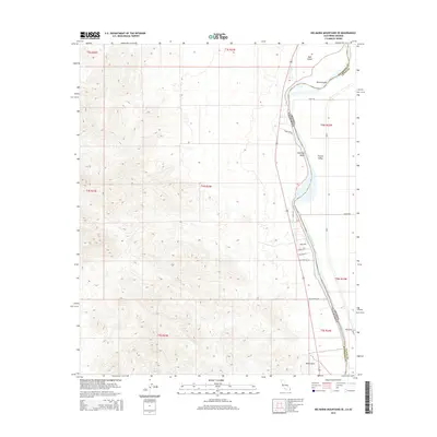
2015 Map of Big Maria Mountains SE
USGS Topo · Published 2015About this map
The Colorado River forms a winding natural boundary between California and Arizona in this 2015 study, carving a path through the arid landscape of Parker Valley. The map highlights the river's dynamic geography, showing significant features like Halfway Bend and the presence of river landforms including Horse Island and Hall Island. A protective Levee runs along the eastern bank, shielding the low-lying valley from the river's influence. To the west, the terrain rises sharply from the desert floor, while the valley itself is gridded with local access roads such as Tsosie Rd and Wind River Rd. This interface between the river's edge and the high desert is further marked by Black Point, anchoring the southern reaches of the valley. The presence of newer residential naming conventions, such as Villa Shores Dr and Quail Trl, indicates the modern development pattern along the river corridor.
Find a feature on this map
27 named features on this map. Tap any name to fly to it.
Don’t see what you’re looking for? This feature index may not catch every label — zoom into the map to look around manually.
Map Details
Editions of this 2015 Big Maria Mountains SE Map
This is the sole edition of this map. No revisions or reprints were ever made.
Other maps of this area

1931 · Moon Mtn
USGS Topo · 1:62,500

1932 · Moon Mtn
USGS Topo · 1:62,500

1933 · Cunningham Mtn
USGS Topo · 1:48,000

1940 · Dome Rock Mts
USGS Topo · 1:62,500

1942 · Blythe
USGS Topo · 1:250,000

1942 · MOON MTN
USGS Topo · 1:62,500

1945 · Big Maria Mtns
USGS Topo · 1:62,500

1951 · Big Maria Mts
USGS Topo · 1:62,500

1951 · McCoy Wash
USGS Topo · 1:24,000

1951 · Blythe NE
USGS Topo · 1:24,000