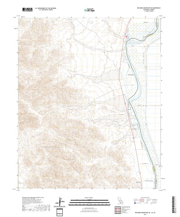
2021 Map of Big Maria Mountains SE
USGS Topo · Published 2021About this map
The Colorado River defines the landscape of this desert borderland, winding south through Halfway Bend and past the expansive Parker Valley. This survey captures the transition from the high, steep slopes of the Big Maria Mountains in the west to the low-lying agricultural and residential developments along the riverbank. Small communities and named lanes like Villa Shores Dr and the uniquely named Rancho Not So Grande appear at the edge of the irrigation network, while landmarks such as Black Point and Horse Island mark the river's path. The map illustrates a complex lattice of rural roads including Beeson Rd and S Clark Ranch Rd, reflecting the managed water systems and settlement patterns along the California and Arizona state line.
Find a feature on this map
29 named features on this map. Tap any name to fly to it.
Don’t see what you’re looking for? This feature index may not catch every label — zoom into the map to look around manually.
Map Details
Editions of this 2021 Big Maria Mountains SE Map
This is the sole edition of this map. No revisions or reprints were ever made.
Other maps of this area

1931 · Moon Mtn
USGS Topo · 1:62,500

1932 · Moon Mtn
USGS Topo · 1:62,500

1933 · Cunningham Mtn
USGS Topo · 1:48,000

1940 · Dome Rock Mts
USGS Topo · 1:62,500

1942 · Blythe
USGS Topo · 1:250,000

1942 · MOON MTN
USGS Topo · 1:62,500

1945 · Big Maria Mtns
USGS Topo · 1:62,500

1951 · Big Maria Mts
USGS Topo · 1:62,500

1951 · McCoy Wash
USGS Topo · 1:24,000

1951 · Blythe NE
USGS Topo · 1:24,000