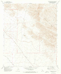
1971 Map of Big Maria Mts SW
USGS Topo · Published 1973About this map
The Big Maria Mountains dominate the eastern half of this terrain, where steep slopes meet the desert floor in Riverside County. In the early 1970s, this landscape was defined by industrial exploration and transit. The southwestern foothills and alluvial plains are marked by numerous extraction sites, including a Mine, scattered Prospects, and specific Drill Holes that indicate active mineral survey work.
Find a feature on this map
15 named features on this map. Tap any name to fly to it.
Don’t see what you’re looking for? This feature index may not catch every label — zoom into the map to look around manually.
Map Details
Editions of this 1971 Big Maria Mts SW Map
2 editions found
Other maps of this area

1942 · Blythe
USGS Topo · 1:250,000

1945 · Big Maria Mtns
USGS Topo · 1:62,500

1945 · Midland
USGS Topo · 1:62,500

1951 · Big Maria Mts
USGS Topo · 1:62,500

1951 · McCoy Wash
USGS Topo · 1:24,000

1951 · Blythe NE
USGS Topo · 1:24,000

1952 · Midland
USGS Topo · 1:62,500

1952 · Mc Coy Spring
USGS Topo · 1:62,500

1954 · Salton Sea
USGS Topo · 1:250,000
1954 · Big Maria Mts. NE
USGS Topo · 1:24,000