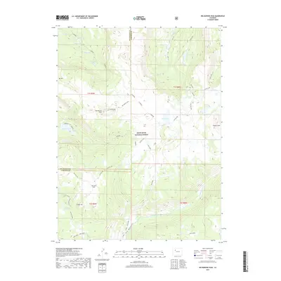
2019 Map of Big Marvine Peak
USGS Topo · Published 2019About this map
White River National Forest encompasses this high-altitude landscape where the boundary between Rio Blanco and Garfield counties cuts through a series of alpine basins and dramatic summits. The area is defined by its water systems, notably the Marvine Lakes and Big Fish Lake, which feed the drainages of Marvine Cr and Big Fish Cr. High peaks including Big Marvine Peak and Himes Peak dominate the skyline, while specialized landmarks like Lost Solar Park and The Meadows indicate specific grazing or recreational clearings within the timbered reaches. The network of trails, such as the E Marvine and Oyster Lake routes, reflects a long-standing infrastructure for forest management and backcountry access, linking scattered water bodies like Florence Lake and Gwendolen Lake across the divide.
Find a feature on this map
43 named features on this map. Tap any name to fly to it.
Don’t see what you’re looking for? This feature index may not catch every label — zoom into the map to look around manually.
Map Details
Editions of this 2019 Big Marvine Peak Map
This is the sole edition of this map. No revisions or reprints were ever made.
Other maps of this area

1927 · Glenwood Springs
USGS Topo · 1:125,000

1930 · Glenwood Springs
USGS Topo · 1:125,000

1954 · Craig
USGS Topo · 1:250,000

1957 · Craig
USGS Topo · 1:250,000

1957 · Leadville
USGS Topo · 1:250,000

1958 · Craig
USGS Topo · 1:250,000

1959 · Leadville
USGS Topo · 1:250,000

1960 · Leadville
USGS Topo · 1:250,000

1960 · Craig
USGS Topo · 1:250,000

1962 · Leadville
USGS Topo · 1:250,000