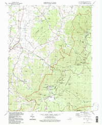
1994 Map of Big Meadows
USGS Topo · Published 1997About this map
Shenandoah National Park dominates this survey, showcasing the high-elevation recreation areas along Skyline Drive during the mid-1990s. The map centers on the Big Meadows plateau, a key destination featuring the Byrd Visitor Center, an Amphitheater, and a Ranger Station. Further north, the Skyland development sits near Millers Head Lookout and the Bushytop peak. This documentation captures the intersection of federally protected wilderness and the rural communities of the Hawksbill Valley below.
Find a feature on this map
90 named features on this map. Tap any name to fly to it.
Don’t see what you’re looking for? This feature index may not catch every label — zoom into the map to look around manually.
Map Details
Editions of this 1994 Big Meadows Map
This is the sole edition of this map. No revisions or reprints were ever made.
Other maps of this area

1892 · Woodstock
USGS Topo · 1:125,000

1892 · Gordonsville
USGS Topo · 1:125,000

1892 · Harrisonburg
USGS Topo · 1:125,000

1893 · Luray
USGS Topo · 1:125,000

1905 · Luray
USGS Topo · 1:125,000

1929 · Stony Man
USGS Topo · 1:48,000

1930 · Madison
USGS Topo · 1:48,000

1933 · Stony Man
USGS Topo · 1:62,500

1933 · Madison
USGS Topo · 1:62,500

1937 · Elkton
USGS Topo · 1:62,500