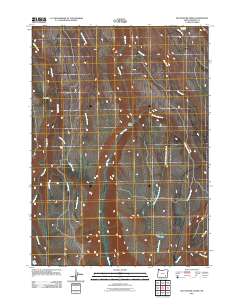
2011 Map of Big Pasture Creek
USGS Topo · Published 2011About this map
Kiger Gorge anchors this high-elevation landscape in Harney County, where steep drainage systems define the rugged terrain of southeastern Oregon. The map illustrates a complex network of seasonal and perennial waterways, including the prominent Big Pasture Creek and its tributary, West Fork Big Pasture Creek. The presence of Doe Camp in the northwest suggests the long-standing use of this high country for seasonal grazing or hunting, a pattern common to the Steens Mountain region. Evidence of the area's essential water sources is found at Waterhole Spring and along the various creeks like McCoy Creek and Cucamonga Creek. This 2011 survey captures the hydrological character of the Steens area before more recent environmental changes, showing how natural landmarks like Trail Creek and Basque Creek serve as critical reference points in an otherwise sparsely populated wilderness.
Find a feature on this map
16 named features on this map. Tap any name to fly to it.
Don’t see what you’re looking for? This feature index may not catch every label — zoom into the map to look around manually.
Map Details
Editions of this 2011 Big Pasture Creek Map
This is the sole edition of this map. No revisions or reprints were ever made.
Other maps of this area

1955 · Adel
USGS Topo · 1:250,000

1957 · Adel
USGS Topo · 1:250,000

1958 · Adel
USGS Topo · 1:250,000

1962 · Adel
USGS Topo · 1:250,000

1968 · Poison Springs
USGS Topo · 1:24,000

1968 · Fish Lake
USGS Topo · 1:24,000

1968 · Wildhorse Lake
USGS Topo · 1:24,000
1968 · Krumbo Ridge
USGS Topo · 1:24,000

1968 · Big Pasture Creek
USGS Topo · 1:24,000
1968 · Mc Coy Ridge
USGS Topo · 1:24,000