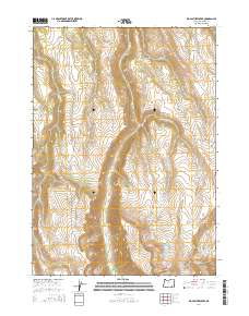
2014 Map of Big Pasture Creek
USGS Topo · Published 2014About this map
Steens Mtn dominates the high-elevation landscape of this Harney County quadrangle, a region defined by dramatic glacial carving and deep drainage basins. The massive Kiger Gorge serves as a central geological landmark, while the unusual depression known as Hole in the Ground sits tucked near Trail Cr in the southeastern corner. This area remains largely defined by its natural hydrology, with numerous seasonal and perennial flows like Kiger Cr, Big Pasture Creek, and Cucamonga Cr dissecting the high desert plateaus. Modern access to this remote corner of the Oregon high country is primarily facilitated by the Diamond Loop Back Country Bywy, which skirts the western edges of the terrain near McCoy Ridge. The density of named creek systems, including W Fork Big Pasture Cr and Mud Cr, suggests a landscape shaped by significant snowmelt and runoff patterns.
Find a feature on this map
22 named features on this map. Tap any name to fly to it.
Don’t see what you’re looking for? This feature index may not catch every label — zoom into the map to look around manually.
Map Details
Editions of this 2014 Big Pasture Creek Map
This is the sole edition of this map. No revisions or reprints were ever made.
Other maps of this area

1955 · Adel
USGS Topo · 1:250,000

1957 · Adel
USGS Topo · 1:250,000

1958 · Adel
USGS Topo · 1:250,000

1962 · Adel
USGS Topo · 1:250,000

1968 · Poison Springs
USGS Topo · 1:24,000

1968 · Fish Lake
USGS Topo · 1:24,000

1968 · Wildhorse Lake
USGS Topo · 1:24,000
1968 · Krumbo Ridge
USGS Topo · 1:24,000

1968 · Big Pasture Creek
USGS Topo · 1:24,000
1968 · Mc Coy Ridge
USGS Topo · 1:24,000