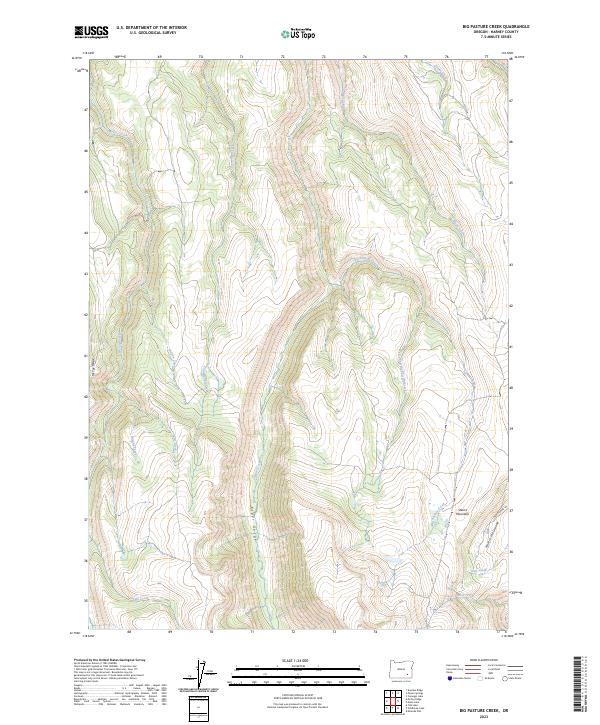
2023 Map of Big Pasture Creek
USGS Topo · Published 2023About this map
Steens Mountain dominates the landscape of southeastern Oregon, where deep glacial carving has formed the dramatic Kiger Gorge. This high-altitude terrain is preserved within the Steens Mountain Wilderness, a region defined by its sharp vertical relief and the drainage systems of the Wildhorse and Kiger Creeks Wild and Scenic River. The map captures the complex hydrology of the eastern fault block, where numerous waterways like McCoy Creek, Cucamonga Creek, and Big Pasture Creek descend from high ridges toward the valley floor.
Find a feature on this map
24 named features on this map. Tap any name to fly to it.
Don’t see what you’re looking for? This feature index may not catch every label — zoom into the map to look around manually.
Map Details
Editions of this 2023 Big Pasture Creek Map
This is the sole edition of this map. No revisions or reprints were ever made.
Other maps of this area

1955 · Adel
USGS Topo · 1:250,000

1957 · Adel
USGS Topo · 1:250,000

1958 · Adel
USGS Topo · 1:250,000

1962 · Adel
USGS Topo · 1:250,000

1968 · Poison Springs
USGS Topo · 1:24,000

1968 · Fish Lake
USGS Topo · 1:24,000

1968 · Wildhorse Lake
USGS Topo · 1:24,000
1968 · Krumbo Ridge
USGS Topo · 1:24,000

1968 · Big Pasture Creek
USGS Topo · 1:24,000
1968 · Mc Coy Ridge
USGS Topo · 1:24,000