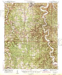
1943 Map of Big Piney
USGS Topo · Published 1943About this map
Fort Leonard Wood and the Mark Twain National Forest dominate this landscape during the early 1940s, a period of transition as military expansion and forest management reshaped the rural Ozarks. The winding course of the Big Piney River and Roubidoux Creek provided the primary geographic framework for early settlement, evidenced by the high density of country schools like Hopewell Sch and Democrat Sch.
Find a feature on this map
59 named features on this map. Tap any name to fly to it.
Don’t see what you’re looking for? This feature index may not catch every label — zoom into the map to look around manually.
Map Details
Editions of this 1943 Big Piney Map
2 editions found
Other maps of this area

1912 · Rolla
USGS Topo · 1:62,500

1931 · Manes
USGS Topo · 1:48,000

1936 · Waynesville
USGS Topo · 1:48,000

1937 · Edgar Springs
USGS Topo · 1:48,000

1941 · Big Piney
USGS Topo · 1:62,500

1941 · Manes
USGS Topo · 1:62,500

1941 · Bado
USGS Topo · 1:62,500

1942 · Waynesville
USGS Topo · 1:62,500

1943 · Richland
USGS Topo · 1:62,500

1943 · Big Piney
USGS Topo · 1:62,500