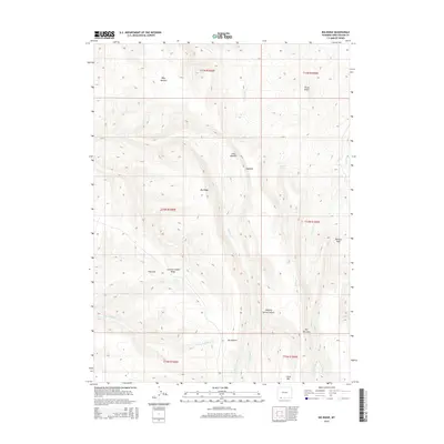
2015 Map of Big Ridge
USGS Topo · Published 2015About this map
Big Ridge anchors this high-elevation landscape in Sweetwater County, where the topography transition from broad flats like Big Pasture and Janes Meadow to the sharp relief of Hogback. The 2015 USGS survey reveals an intricate drainage system feeding into Currant Cr and Trout Cr, with numerous seasonal water sources such as Coyote Spring, Spitzi Spring, and Deer Spring supporting life in this arid region.
Find a feature on this map
30 named features on this map. Tap any name to fly to it.
Don’t see what you’re looking for? This feature index may not catch every label — zoom into the map to look around manually.
Map Details
Editions of this 2015 Big Ridge Map
This is the sole edition of this map. No revisions or reprints were ever made.
Other maps of this area

1954 · Rock Springs
USGS Topo · 1:250,000

1957 · Currant Creek Ranch
USGS Topo · 1:62,500

1957 · Firehole Basin
USGS Topo · 1:62,500

1958 · Rock Springs
USGS Topo · 1:250,000

1962 · Rock Springs
USGS Topo · 1:250,000
1963 · Maxon Ranch
USGS Topo · 1:24,000
1963 · Richards Gap
USGS Topo · 1:24,000

1966 · Firehole Basin
USGS Topo · 1:62,500

1966 · Currant Creek Ranch
USGS Topo · 1:62,500
1968 · Earnest Butte
USGS Topo · 1:24,000