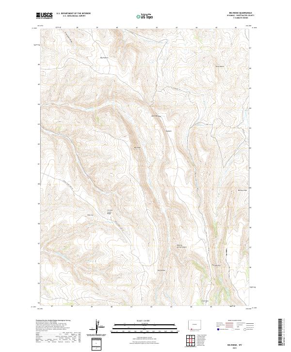
2021 Map of Big Ridge
USGS Topo · Published 2021About this map
The Cherokee Trl cuts across this high-altitude landscape in Sweetwater County, following a route used by emigrants and travelers through the western frontier. This 2021 survey details a complex network of high ridges and deep drainages, including the prominent Big Ridge and the Currant Creek Ridge Rd which winds along the spine of Currant Creek Ridge. This area is defined by its water sources, from the isolated Coyote Spring and Spitzi Spring to the seasonal flows of Sugarloaf Marsh Cr and Trout Cr.
Find a feature on this map
34 named features on this map. Tap any name to fly to it.
Don’t see what you’re looking for? This feature index may not catch every label — zoom into the map to look around manually.
Map Details
Editions of this 2021 Big Ridge Map
This is the sole edition of this map. No revisions or reprints were ever made.
Other maps of this area

1954 · Rock Springs
USGS Topo · 1:250,000

1957 · Currant Creek Ranch
USGS Topo · 1:62,500

1957 · Firehole Basin
USGS Topo · 1:62,500

1958 · Rock Springs
USGS Topo · 1:250,000

1962 · Rock Springs
USGS Topo · 1:250,000
1963 · Maxon Ranch
USGS Topo · 1:24,000
1963 · Richards Gap
USGS Topo · 1:24,000

1966 · Firehole Basin
USGS Topo · 1:62,500

1966 · Currant Creek Ranch
USGS Topo · 1:62,500
1968 · Earnest Butte
USGS Topo · 1:24,000