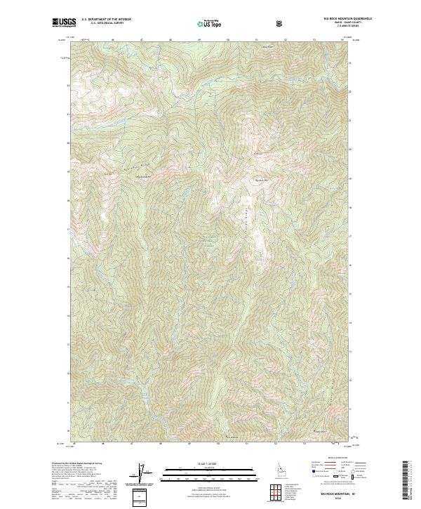
2024 Map of Big Rock Mountain
USGS Topo · Published 2024About this map
Stuart Hot Springs and the headwaters of the West Fork Three Links Creek mark the southern reaches of this mountainous Idaho interior. Situated within the protected boundaries of the Selway-Bitterroot Wilderness and Nez Perce National Forest, the landscape is defined by its complex drainage network and high-elevation landmarks. Sharp ridgelines like Blacktail Ridge and Sixtytwo Ridge separate deep creek valleys, including those of Rhoda Creek and Lizard Creek. This map illustrates the primary topography of the Clearwater National Forest region, highlighting remote points of interest such as Parsons Spring and Bear Wallow. Significant peaks including Big Rock Mtn and North Peak dominate the central terrain, providing a look at the hydrography that feeds the Lochsa and Selway river basins.
Find a feature on this map
31 named features on this map. Tap any name to fly to it.
Don’t see what you’re looking for? This feature index may not catch every label — zoom into the map to look around manually.
Map Details
Editions of this 2024 Big Rock Mountain Map
This is the sole edition of this map. No revisions or reprints were ever made.
Other maps of this area

1911 · Lolo
USGS Topo · 1:250,000

1913 · Lolo
USGS Topo · 1:250,000

1956 · Hamilton
USGS Topo · 1:250,000

1959 · Hamilton
USGS Topo · 1:250,000

1960 · Hamilton
USGS Topo · 1:250,000

1964 · Hamilton
USGS Topo · 1:250,000

1966 · Mc Connell Mtn
USGS Topo · 1:24,000

1966 · Moose Ridge
USGS Topo · 1:24,000
1966 · Fog Mountain
USGS Topo · 1:24,000
1966 · Big Rock Mtn
USGS Topo · 1:24,000