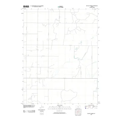
2009 Map of Big Salt Marsh
USGS Topo · Published 2009About this map
Hydrological management and agricultural grid patterns define this portion of Stafford County. Water features like Salt Creek and the man-made Rattlesnake Canal represent the vital intersection of natural drainages and irrigation engineering in the Kansas plains. The landscape is structured by a rigorous network of section-line roads, including NE 140th St and NE 100th Ave, which facilitate the regional transport and farming economy. In the eastern reaches, the West Canal further illustrates the scale of water diversion necessary for large-scale cultivation. This 2009 survey by the U.S. Geological Survey provides a clear view of the rural infrastructure and water systems that sustain the local community.
Find a feature on this map
14 named features on this map. Tap any name to fly to it.
Don’t see what you’re looking for? This feature index may not catch every label — zoom into the map to look around manually.
Map Details
Editions of this 2009 Big Salt Marsh Map
This is the sole edition of this map. No revisions or reprints were ever made.
Other maps of this area

1891 · Great Bend
USGS Topo · 1:125,000

1893 · Great Bend
USGS Topo · 1:125,000

1894 · Lyons
USGS Topo · 1:125,000

1955 · Great Bend
USGS Topo · 1:250,000

1957 · Great Bend
USGS Topo · 1:250,000

1957 · Ellinwood SW
USGS Topo · 1:24,000

1957 · Ellinwood
USGS Topo · 1:24,000

1958 · Great Bend
USGS Topo · 1:250,000

1967 · Alden NW
USGS Topo · 1:24,000
1970 · Raymond
USGS Topo · 1:24,000