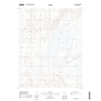
2018 Map of Big Salt Marsh
USGS Topo · Published 2018About this map
Big Salt Marsh dominates this landscape in Stafford County, representing a rare inland saline wetland ecosystem. This 2018 survey reveals the complex hydrology of the region, where the marsh is fed and drained by features such as Salt Cr and the engineered Rattlesnake Canal. The presence of Boiling Springs within the marshy lowlands suggests significant groundwater discharge points that maintain these unique conditions.
Find a feature on this map
25 named features on this map. Tap any name to fly to it.
Don’t see what you’re looking for? This feature index may not catch every label — zoom into the map to look around manually.
Map Details
Editions of this 2018 Big Salt Marsh Map
This is the sole edition of this map. No revisions or reprints were ever made.
Other maps of this area

1891 · Great Bend
USGS Topo · 1:125,000

1893 · Great Bend
USGS Topo · 1:125,000

1894 · Lyons
USGS Topo · 1:125,000

1955 · Great Bend
USGS Topo · 1:250,000

1957 · Great Bend
USGS Topo · 1:250,000

1957 · Ellinwood SW
USGS Topo · 1:24,000

1957 · Ellinwood
USGS Topo · 1:24,000

1958 · Great Bend
USGS Topo · 1:250,000

1967 · Alden NW
USGS Topo · 1:24,000
1970 · Raymond
USGS Topo · 1:24,000