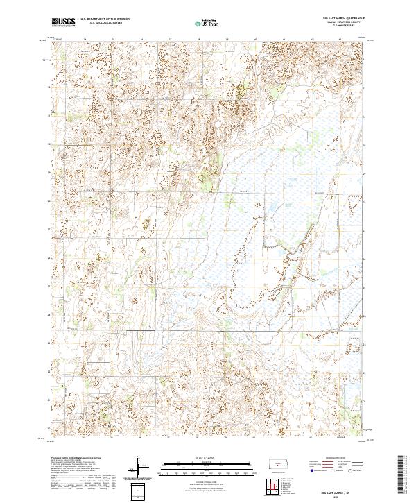
2022 Map of Big Salt Marsh
USGS Topo · Published 2022About this map
Big Salt Marsh dominates this landscape in northern Stafford County, where complex hydrological features meet the rigid grid of the Public Land Survey System. The area is characterized by a significant wetland system that includes the namesake marsh and the distinct bubbling waters of Boiling Springs. Human modification of the drainage is evident through the presence of the Rattlesnake Canal and W Canal, which cut through the low-lying terrain alongside Salt Cr. The map reveals a strictly rural township structure, with section lines marked by a network of numbered avenues and streets, such as NE 130th Ave and NE 140th St, showing the agricultural organization of this central Kansas region in the early 21st century.
Find a feature on this map
26 named features on this map. Tap any name to fly to it.
Don’t see what you’re looking for? This feature index may not catch every label — zoom into the map to look around manually.
Map Details
Editions of this 2022 Big Salt Marsh Map
This is the sole edition of this map. No revisions or reprints were ever made.
Other maps of this area

1891 · Great Bend
USGS Topo · 1:125,000

1893 · Great Bend
USGS Topo · 1:125,000

1894 · Lyons
USGS Topo · 1:125,000

1955 · Great Bend
USGS Topo · 1:250,000

1957 · Great Bend
USGS Topo · 1:250,000

1957 · Ellinwood SW
USGS Topo · 1:24,000

1957 · Ellinwood
USGS Topo · 1:24,000

1958 · Great Bend
USGS Topo · 1:250,000

1967 · Alden NW
USGS Topo · 1:24,000
1970 · Raymond
USGS Topo · 1:24,000