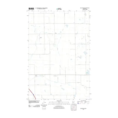
2010 Map of Big Slough
USGS Topo · Published 2010About this map
Gran Cemetery sits at the center of this agricultural landscape in Clay County, marking a point of rest in a region defined by its waterway network and section-line roads. The drainage of the land is visible through the meandering paths of Whisky Creek, Stony Creek, and Spring Creek, which navigate the grid of county highways and local avenues. This 2010 survey shows the area's development through features like the Janssen Airport and the Willow Creek Golf Course, which contrast with the surrounding rural expanses and the natural basin of Solem Lake. The intricate web of named roads, including County Hwy-120 and County Hwy-126, illustrates the modern connectivity of this prairie landscape, providing a clear view of how traditional farm boundaries and newer recreational or transport infrastructure coexist.
Find a feature on this map
31 named features on this map. Tap any name to fly to it.
Don’t see what you’re looking for? This feature index may not catch every label — zoom into the map to look around manually.
Map Details
Editions of this 2010 Big Slough Map
This is the sole edition of this map. No revisions or reprints were ever made.
Other maps of this area

1914 · Pelican Rapids
USGS Topo · 1:62,500

1917 · Pelican Rapids
USGS Topo · 1:62,500

1919 · Barnesville
USGS Topo · 1:62,500

1919 · Hawley
USGS Topo · 1:62,500

1952 · Barnesville
USGS Topo · 1:62,500

1953 · Fargo
USGS Topo · 1:250,000

1956 · Fargo
USGS Topo · 1:250,000
1966 · Hawley SE
USGS Topo · 1:24,000
1966 · Downer
USGS Topo · 1:24,000
1966 · Lake Park SW
USGS Topo · 1:24,000